
A Chinese artificial intelligence company with reported links to Iran’s Islamic Revolutionary Guard Corps has been publishing high-resolution satellite images of US bombers at RAF Fairford, raising fresh concerns over the vulnerability of American military installations in Britain.
MizarVision, which uses artificial intelligence to identify military equipment in commercial and radar satellite imagery, reportedly monitored the precise positions of aircraft at the Gloucestershire airbase over several months, beginning as hostilities with Iran erupted.
The intelligence was distributed online, including through the Chinese social media platform Weibo, exposing the location of valuable US military assets to potential adversaries.
Military analysts have warned that the detailed imagery could be exploited to plan attacks, including drone strikes, against installations hosting American forces. The revelations, first reported by The Sun, add to mounting concerns about Iran-linked threats to US bases across the UK.
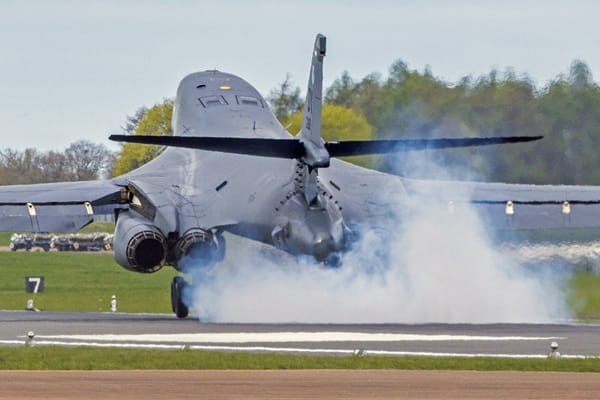
The United States relocated its fleet of nine Rockwell B-1B Lancer bombers from RAF Fairford last month. Analysts believe the exposure of their positions may have contributed to the decision.
Colonel Simon Diggins, a former British Army officer who now works as a security analyst, warned that the satellite intelligence could provide terrorists with a readily accessible picture of potential targets.
He also suggested a possible connection between MizarVision’s activities and a security threat at Fairford that led counter-terrorism officers to detain seven men in September.
“I think it was that which probably spooked the Americans, who were probably thinking, ‘they know where our bombers are’,” he told The Sun.
Dr Mark Hilborne, of the Defence Studies Department at King’s College London, said it was “highly likely” that the company was passing information to Tehran.
He warned that MizarVision could be continuously monitoring sensitive military locations across Britain, drawing comparisons with the use of satellite imagery by Russia’s Wagner Group to identify Ukrainian positions.
The company’s activities have also attracted attention because of earlier imagery it published of Prince Sultan Air Base in Saudi Arabia. On February 27, one day before hostilities with Iran began, MizarVision released satellite photographs of the installation.
American officials have indicated that the posts were probably connected to Iranian strikes on the base less than two days later. The attack killed a US service member.
The latest revelations come amid a series of security incidents involving American airbases in Britain.
RAF Lakenheath in Suffolk was placed under lockdown on Friday evening following reports of suspected unauthorised drone activity near the installation. The US Air Force subsequently resumed normal security operations.
Earlier, on November 9, an Iran-linked security threat at nearby RAF Mildenhall prompted American forces to withdraw at least 12 aircraft from the base.
Taken together, the incidents raise questions about whether foreign adversaries can use inexpensive commercial technology and publicly available information to identify, monitor and potentially threaten strategically important military assets.
The use of artificial intelligence to analyse satellite photographs makes the challenge more acute. Imagery that might once have required specialist military expertise can now be processed to identify aircraft, track movements and map activity around sensitive installations.
A Ministry of Defence spokesman said the security of British personnel, sites and capabilities was kept under constant review.
“We actively track commercial satellite imagery which is publicly available and monitor threats,” the spokesman said.
The statement underlines the difficulty facing Western defence planners: military bases may be heavily guarded on the ground, but their aircraft and movements can still be exposed from space.
For US forces operating in Britain, the emerging threat is no longer confined to the perimeter fence. It may begin thousands of miles away, with a satellite photograph and an algorithm capable of identifying exactly what is parked on the runway.


Leave a Comment