
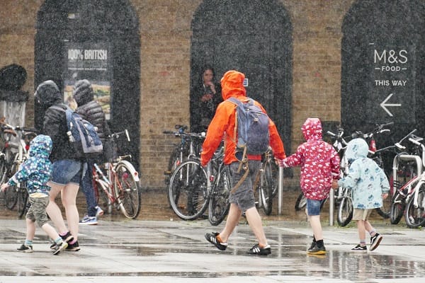
Britain is bracing for a potentially wet and stormy bank holiday weekend after the Met Office issued a yellow thunderstorm warning covering large parts of England and Wales.
The warning, issued shortly after 9am, comes into force at noon on Friday and remains in place until 9pm, with heavy showers, thunderstorms, hail and intense bursts of rainfall expected across parts of the country.
The alert covers the East Midlands, East of England, North East England, North West England, Wales, West Midlands and Yorkshire & Humber. Oxfordshire is the only area affected within the London and South East England region, while Gloucestershire is also covered.
The Met Office warned that driving conditions could deteriorate as a result of spray, standing water and hail, potentially causing longer journey times for motorists and bus passengers.
Rail passengers could also face disruption, while flooding of homes and businesses is possible in some locations, with the potential for damage to buildings and other structures.
Lightning strikes could cause additional damage and short-term power outages are also possible.
Although many areas will escape the most intense rainfall, heavy showers and thunderstorms are expected to develop through Friday afternoon and evening.
The focus is expected to be on northern England and much of Wales during the early afternoon before the storms spread towards central and eastern England.
Some locations could see 10-20mm of rain falling within a short period, while repeated downpours could produce totals of 30-40mm.
Lightning and hail will provide additional hazards in some areas before the storms gradually ease on Friday evening.
The unsettled conditions are expected to continue into the bank holiday weekend, although the storms also bring a sharp change from the warm and humid weather experienced across Britain during the summer.
Temperatures are forecast to remain close to the seasonal average, reaching 20-23C across England and Wales and 16-20C in Scotland and Northern Ireland.
Saturday is expected to bring a mixture of sunny spells, heavy showers and a continued risk of thunderstorms, accompanied by westerly winds. Temperatures should reach 18-22C in England and Wales and 16-19C further north.
Further heavy showers and longer spells of rain could disrupt plans on Sunday, with thunderstorms remaining a possibility.
Scotland is expected to be the wettest part of the UK on Monday, although periods of sunshine could break through the showers. More Atlantic rain is then forecast to move across the country, with winds strengthening in southern areas.
Temperatures in southern Britain are expected to range between 16C and 23C.
The wet weather comes against an unusually dry backdrop. A prolonged sequence of heatwaves and low rainfall has produced the driest July in 190 years, while 71.3 per cent of England and the whole of Wales have been placed in drought.
The conditions have put pressure on water supplies, wildlife, agriculture, emergency services and infrastructure.
Reservoir levels have fallen to 62.6 per cent, 16.3 percentage points below the level normally expected at this time of year, according to Defra.
The prospect of a dramatic change in weather has also prompted the government to consider the possibility that the drought could eventually give way to a much wetter season.
Following an emergency meeting on the heatwave last week, Prime Minister Andy Burnham warned that the country could face a sharp reversal in conditions.
“We might be in for a wet autumn and winter straight after this, because of El Nino and some of the issues there, which was reported to Cobra.”
For holidaymakers, however, the immediate outlook is less encouraging: the first major bank holiday weekend following Britain’s record-breaking summer is increasingly likely to be defined by thunderstorms, heavy rain and disrupted travel.




Leave a Comment