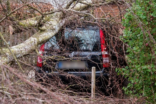
A tornado has hit parts of Nottingham which has damaged dozens of homes in West Bridgford which has caused a number of trees to fall.
Roofs have been torn off, local businesses have been damaged and broken branches are blocking roads.
Another tornado hit Knutton near to Stoke-on-Trent which caused damage and scattered debris.
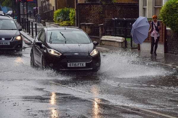
The Met Office has issued a yellow weather warning for strong winds which is expected to last until 10pm on Monday.
They also warned there could be power cuts and transport delays as gusts will reach 40 mph.
Reports of a tornado in Knutton, near Stoke-On-Trent this morning with damage to fences & bins scattered all over the place. pic.twitter.com/SIFviKrQSV
— Met4Cast. (@Met4CastUK) April 15, 2024
Stephen Dixon, Met Office spokesperson, said, “Tornadoes do happen in the UK and they’re generally short-lived in nature, but around 30 a year are reported on average.
“Today there have been some reports of some particularly impactful winds.
“The fronts that were moving southwards this morning had some potential for some short-lived tornadoes within them, but we would need to assess the impact.”
The Met Office defines a tornado as a “rapidly rotating column of air that reaches the base of a storm cloud and the Earth’s surface.”
In a statement, the Met Office said, “A depression will move east just to the north of Scotland through Monday and will bring a swath of strong winds to Northern Ireland, Wales and much of England.
“Gusts of between 40 and 45 mph are expected widely inland with isolated gusts as high as 50 to 55 mph on exposed coasts and near to heavier showers.
“This is likely to lead to some disruption and longer journey times. Winds will slowly ease through the evening and first part of Monday night.”
A tornado has hit West Bridgford and parts of Nottingham causing fallen trees narrowly missing houses, broken branches blocking roads, roofs ripped off, and damage to homes and local businesses. We hope everyone is safe, and please take care on the roads. We believe the trees are… pic.twitter.com/4KBAlJOuro
— Notts TV (@Notts_TV) April 15, 2024
Phil Morrish who is a weather expert has warned there could be more smaller tornadoes on Monday.
Morrish told the Express, “This morning we’ve had an active cold front which has moved south through the country – cold front.
“Within the squall line the clouds are building up to 40,000 feet and within these are a large number of downdrafts, in among these are a series of drafts. These up-and-down drafts have become so violent they’ve hit the ground.
“It’s now moving into Surrey and southern parts of England with the possibility of a small tornado later on. It looks like the winds from this morning will reach 50 to 70mph.”
Footage of the earlier unconfirmed tornado on Knutton!
Could potentially be straight line winds. pic.twitter.com/IP4TuY5rjV
— Met4Cast. (@Met4CastUK) April 15, 2024
Another weather expert Jim Dale told the publication why the UK are seeing tornadoes hitting parts of the UK on Monday.
Dale said, “If it is a tornado then it’s a mini tornado in 10-minute scenarios on the back of the cold front that came through.
“It’s either a tornado or a very acute squall line, it’s one or the other.”There could be one or two more instances this afternoon because we’re in the polar airstream which is behind the cold front containing some vigorous showers.
“They can do damage and Knutton is on the map because of that.”


Leave a Comment