Storm Herminia which was named by the Spanish Meteorological Service is to bring further rain, strong winds and heavy rain.
The Met Office has yellow weather warnings in place for southern England and Wales for Monday and Tuesday.
Met Office Chief Meteorologist Frank Saunders said, “A deep area of low pressure brought further strong winds, heavy rain and some thunderstorms to the south of the UK on Sunday.
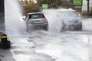
“This system stays around for much of Monday and Monday night, bringing further bands of blustery showers, especially to the south before slowly easing on Tuesday. With the ground already wet, further flooding impacts, which will primarily affect road traffic, are possible.
“Additional hazards could include further lightning strikes and hail making road conditions dangerous.
“Strong winds will also affect southern parts of England and Wales through Monday and at first on Tuesday, with gusts of up to 60 or 70mph possible near the coasts in the far southwest, and around 50mph possible inland especially near to the heaviest showers.
“The strong winds will also gradually ease from the west on Tuesday. Temperatures will be close to the seasonal average but feeling colder than this in the strong and gusty winds in the south.”
By Wednesday the storm will have moved from the UK, but there will be sunny spells and showers which could bring thundery weather in the north.
Thursday will be quieter and less windy and drier day, and in the northwest, there will be outbreaks of snow and rain by the end of the day.
Met Office Deputy Chief Meteorologist Chris Almond said, “Most areas will be dry with sunny spells on Thursday, although there’s the risk of some freezing fog patches at first.
“Cloud, outbreaks of rain and hill snow will spread to the northwest by the end of the day, and Friday will see a cloudy day in the south, with some sunshine further north, before the next band of cloud and rain arrives in the northwest later. Overall though, rainfall amounts will be lower than of late.”


Leave a Comment